1956 Map of Danville
USGS Topo · Published 1956About this map
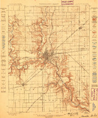
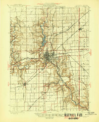
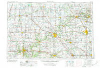
The Wabash River valley serves as a primary corridor through this mid-1950s landscape, connecting major regional hubs like Lafayette, Logansport, and Peru. The map illustrates a mature rail infrastructure during the transition to a modernized highway system, featuring the New York Central, Pennsylvania, and Wabash railroads alongside developing U.S. routes. Beyond the industrial and agricultural centers of Danville and Kokomo, the sheet details significant recreational and natural landmarks. Local history and conservation are marked by Kickapoo State Park and the historic Battle Ground. The hydrology of the region is prominent, from the man-made Lake Shafer and Lake Freeman to the wandering paths of the Tippecanoe River and Sugar Creek, showing how water resources were integrated into the mid-century development of Indiana and Illinois.
Find a feature on this map
191 named features on this map. Tap any name to fly to it.
Don’t see what you’re looking for? This feature index may not catch every label — zoom into the map to look around manually.
Map Details
Editions of this 1956 Danville Map
This is the sole edition of this map. No revisions or reprints were ever made.
Historical Maps of Carmel Through Time
7 maps found