
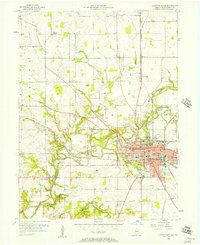
1956 Map of Crawfordsville
USGS Topo · Published 1957About this map
Crawfordsville serves as the industrial and educational heart of Montgomery County in the mid-1950s, centered on the winding path of Sugar Creek. The city's growth is clearly defined by the intersection of the Monon and Pennsylvania railroads, while the New York Central line pushes west toward Yountsville. This era captures the transition of the urban fringe, where longtime agricultural institutions like the County Farm and Oak Hill Cemetery meet new suburban expansion.
Find a feature on this map
62 named features on this map. Tap any name to fly to it.
Don’t see what you’re looking for? This feature index may not catch every label — zoom into the map to look around manually.
Map Details
Editions of this 1956 Crawfordsville Map
4 editions found
Other maps of this area

1949 · Alamo
USGS Topo · 1:24,000

1953 · Danville
USGS Topo · 1:250,000

1953 · Indianapolis
USGS Topo · 1:250,000

1955 · Danville
USGS Topo · 1:250,000

1956 · Danville
USGS Topo · 1:250,000

1956 · Indianapolis
USGS Topo · 1:250,000

1956 · New Market
USGS Topo · 1:24,000

1957 · Indianapolis
USGS Topo · 1:250,000

1958 · Darlington
USGS Topo · 1:24,000

1958 · Linden
USGS Topo · 1:24,000