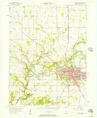
1956 Map of Crawfordsville
USGS Topo · Published 1973About this map
Sugar Creek winds through the heart of Montgomery County, anchoring the landscape of Crawfordsville during the mid-1950s. The city is established as a regional center of education and industry, centered around the campus of Wabash College and the local seat of government at the Courthouse. This era shows a community defined by its institutional strength, with numerous neighborhood schools like Laura G Hose Sch and John Beard Sch serving growing residential blocks.
Find a feature on this map
59 named features on this map. Tap any name to fly to it.
Don’t see what you’re looking for? This feature index may not catch every label — zoom into the map to look around manually.
Map Details
Editions of this 1956 Crawfordsville Map
4 editions found
Other maps of this area

1949 · Alamo
USGS Topo · 1:24,000

1953 · Danville
USGS Topo · 1:250,000

1953 · Indianapolis
USGS Topo · 1:250,000

1955 · Danville
USGS Topo · 1:250,000

1956 · Danville
USGS Topo · 1:250,000

1956 · Indianapolis
USGS Topo · 1:250,000

1956 · Crawfordsville
USGS Topo · 1:24,000

1956 · New Market
USGS Topo · 1:24,000

1957 · Indianapolis
USGS Topo · 1:250,000

1958 · Darlington
USGS Topo · 1:24,000