
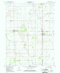
1958 Map of Linden
USGS Topo · Published 1959About this map
Linden and New Richmond serve as the primary hubs in this late 1950s survey of the Tippecanoe and Montgomery County line. The landscape is defined by a grid of rural roads and two major rail lines that intersect the region: the Monon and the New York Chicago and St Louis. This rail-and-road network supported an agricultural economy centered around the drainage basins of the North Fork Coal Creek and Black Creek. Local history is visible in the placement of the Wilson-Killen Cem and the settlement at Mt Pleasant. The map details the transition from the prairie-like flatlands of Randolph and Jackson townships into the more dissected drainage areas of Madison and Union, where numerous ditches like Stock Ditch managed the water across the farmsteads.
Find a feature on this map
23 named features on this map. Tap any name to fly to it.
Don’t see what you’re looking for? This feature index may not catch every label — zoom into the map to look around manually.
Map Details
Editions of this 1958 Linden Map
2 editions found
Other maps of this area

1953 · Danville
USGS Topo · 1:250,000

1955 · Danville
USGS Topo · 1:250,000

1956 · Danville
USGS Topo · 1:250,000

1956 · Crawfordsville
USGS Topo · 1:24,000

1958 · Darlington
USGS Topo · 1:24,000

1958 · Kirkpatrick
USGS Topo · 1:24,000

1961 · Romney
USGS Topo · 1:24,000

1961 · Stockwell
USGS Topo · 1:24,000
1962 · Waynetown
USGS Topo · 1:24,000
1962 · Westpoint
USGS Topo · 1:24,000