
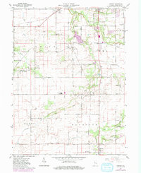
1961 Map of Romney
USGS Topo · Published 1962About this map
Romney and the surrounding agricultural townships of Union, Wea, Jackson, and Randolph are defined here by a network of drainage ditches and small creeks feeding toward the Wabash river. The Monon railroad corridor serves as the primary north-south spine, connecting smaller junctions and grain elevators like those at South Raub and Shadeland. This early 1960s landscape preserves several community focal points, including the Farmers Institute Ch and the Southwestern High Sch, alongside numerous family and community burial grounds such as Elmwood Cem and Mintonye Cem. The presence of several Gravel Pits and Gravel Pits near the watercourses suggests the local importance of aggregate extraction. Communications infrastructure is represented by multiple Radio Towers (WBAA) and Radio Towers (WAZY), marking the modernization of this rural Tippecanoe County landscape.
Find a feature on this map
34 named features on this map. Tap any name to fly to it.
Don’t see what you’re looking for? This feature index may not catch every label — zoom into the map to look around manually.
Map Details
Editions of this 1961 Romney Map
2 editions found
Other maps of this area

1941 · Lafayette
USGS Topo · 1:24,000

1942 · Otterbein
USGS Topo · 1:24,000

1942 · Lafayette
USGS Topo · 1:24,000

1950 · Lafayette
USGS Topo · 1:24,000

1951 · Otterbein
USGS Topo · 1:24,000

1953 · Danville
USGS Topo · 1:250,000

1955 · Danville
USGS Topo · 1:250,000

1956 · Danville
USGS Topo · 1:250,000

1958 · Linden
USGS Topo · 1:24,000

1958 · Kirkpatrick
USGS Topo · 1:24,000