1941 Map of Lafayette
USGS Topo · Published 1941About this map
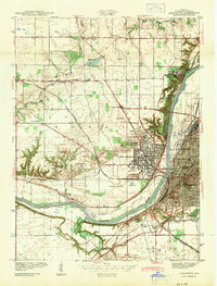
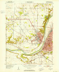
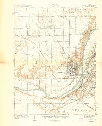
The Wabash River carves a deep valley between the established city of Lafayette and the growing campus of Purdue University in this 1940 survey. This era finds West Lafayette expanding around the university grounds and the Purdue Airport, while the eastern bank is densely packed with the urban grid of Lafayette, including City Hall and St Elizabeth Hospital. On the bluffs north of town, the Indiana State Soldiers Home and Wabash Sanitarium overlook the river valley, flanked by the wooded ravines of Happy Hollow and Cedar Hollow.
Find a feature on this map
62 named features on this map. Tap any name to fly to it.
Don’t see what you’re looking for? This feature index may not catch every label — zoom into the map to look around manually.
Map Details
Editions of this 1941 Lafayette Map
This is the sole edition of this map. No revisions or reprints were ever made.
Historical Maps of Lafayette Through Time
4 maps found