
1961 Map of Stockwell
USGS Topo · Published 1962About this map
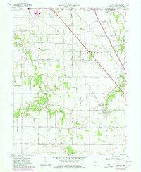
Agricultural fields and riparian corridors define the Tippecanoe County landscape in the early 1960s, anchored by the settlement of Stockwell and the smaller hub of Dayton. The area’s development follows the drainage patterns of Wea Creek and Lauramie Creek, with several smaller waterways like Dismal Creek and Blickenstaff Branch threading between farmsteads. Transportation is dominated by the crossing of the New York Central and St Louis Railroad and the Chicago Indianapolis and Southeastern Railroad, which likely served as the primary economic lifelines for these rural communities.
Find a feature on this map
45 named features on this map. Tap any name to fly to it.
Don’t see what you’re looking for? This feature index may not catch every label — zoom into the map to look around manually.
Map Details
Editions of this 1961 Stockwell Map
2 editions found
Other maps of this area

1941 · Lafayette
USGS Topo · 1:24,000

1942 · Lafayette
USGS Topo · 1:24,000

1950 · Lafayette
USGS Topo · 1:24,000

1953 · Danville
USGS Topo · 1:250,000

1955 · Danville
USGS Topo · 1:250,000

1956 · Danville
USGS Topo · 1:250,000

1958 · Linden
USGS Topo · 1:24,000

1958 · Kirkpatrick
USGS Topo · 1:24,000

1961 · Mulberry
USGS Topo · 1:24,000

1961 · Pyrmont
USGS Topo · 1:24,000