
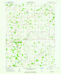
1958 Map of Kirkpatrick
USGS Topo · Published 1959About this map
The Chicago and St Louis railroad cuts diagonally across this landscape, serving the settlement of Kirkpatrick near the junction of Lauramie and Madison townships. The map documents an intensely managed agricultural environment in the late 1950s, characterized by extensive drainage projects like the Armentrout Dredge Ditch, Stock Farm Ditch, and Fraley Ditch. These man-made channels support the fertile prairie soil around the Purdue University Experimental Farm in the north.
Find a feature on this map
23 named features on this map. Tap any name to fly to it.
Don’t see what you’re looking for? This feature index may not catch every label — zoom into the map to look around manually.
Map Details
Editions of this 1958 Kirkpatrick Map
This is the sole edition of this map. No revisions or reprints were ever made.
Other maps of this area

1953 · Danville
USGS Topo · 1:250,000

1955 · Danville
USGS Topo · 1:250,000

1956 · Danville
USGS Topo · 1:250,000

1956 · Crawfordsville
USGS Topo · 1:24,000

1958 · Darlington
USGS Topo · 1:24,000

1958 · Linden
USGS Topo · 1:24,000

1961 · Mulberry
USGS Topo · 1:24,000

1961 · Romney
USGS Topo · 1:24,000

1961 · Stockwell
USGS Topo · 1:24,000
1961 · Shannondale
USGS Topo · 1:24,000