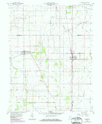
1958 Map of Liinden
USGS Topo · Published 1986About this map
The agrarian landscape of the Montgomery and Tippecanoe county border is defined by a dense grid of rural roads and rail lines. At the center of the sheet, Linden serves as a primary junction where the Norfolk and Western and Seaboard railroads intersect, a pattern repeated to the west at New Richmond. These rail corridors were vital to the local economy, facilitating the transport of agricultural products from the surrounding farmsteads.
Find a feature on this map
28 named features on this map. Tap any name to fly to it.
Don’t see what you’re looking for? This feature index may not catch every label — zoom into the map to look around manually.
Map Details
Editions of this 1958 Liinden Map
2 editions found
Other maps of this area

1953 · Danville
USGS Topo · 1:250,000

1955 · Danville
USGS Topo · 1:250,000

1956 · Danville
USGS Topo · 1:250,000

1956 · Crawfordsville
USGS Topo · 1:24,000

1958 · Darlington
USGS Topo · 1:24,000

1958 · Linden
USGS Topo · 1:24,000

1958 · Kirkpatrick
USGS Topo · 1:24,000

1961 · Romney
USGS Topo · 1:24,000

1961 · Stockwell
USGS Topo · 1:24,000
1962 · Waynetown
USGS Topo · 1:24,000