
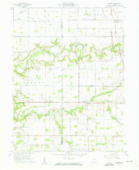
1961 Map of Pyrmont
USGS Topo · Published 1962About this map
Wildcat Creek meanders sharply across this landscape, carving a deep valley through the agricultural plains of Tippecanoe, Carroll, and Clinton counties. The settlement of Pyrmont sits near a prominent bend in the creek, serving as a focal point among smaller communities like Edna Mills, Heath, and Owasco. The drainage patterns are meticulously documented, from the Middle Fork Wildcat Creek to various man-made improvements like Hughes Ditch and Schimmel Ditch, reflecting the intensive land management required for local farming.
Find a feature on this map
53 named features on this map. Tap any name to fly to it.
Don’t see what you’re looking for? This feature index may not catch every label — zoom into the map to look around manually.
Map Details
Editions of this 1961 Pyrmont Map
2 editions found
Other maps of this area

1953 · Danville
USGS Topo · 1:250,000

1955 · Danville
USGS Topo · 1:250,000

1956 · Danville
USGS Topo · 1:250,000

1961 · Mulberry
USGS Topo · 1:24,000

1961 · Stockwell
USGS Topo · 1:24,000

1961 · Lafayette East
USGS Topo · 1:24,000

1961 · Rossville
USGS Topo · 1:24,000

1961 · Frankfort
USGS Topo · 1:24,000

1962 · Flora
USGS Topo · 1:24,000

1962 · Delphi
USGS Topo · 1:24,000