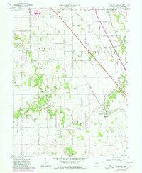
1961 Map of Stockwell
USGS Topo · Published 1980About this map
Stockwell and Dayton anchor this central Indiana landscape, where the agricultural grid is defined by historical township boundaries like Lauramie and Sheffield. The drainage of the till plain is evident in the intricate network of channelized waterways, including Elliott Ditch, Kenny Ditch, and Ilgenfritz Ditch, which support the intensive farming of the region. Transportation patterns are dominated by the Conrail line and the Western and Southeast Road, alongside the uniquely named Treaty Indian Road. Local history is deeply embedded in the land through numerous small burial grounds and rural institutions, from the Kenny Cem and Stingley Cem to the Conarroe Ch and Stockwell High Sch. This survey preserves the spatial relationship between these community markers and the gravel extraction sites, such as the various Gravel Pits, that once powered local development.
Find a feature on this map
44 named features on this map. Tap any name to fly to it.
Don’t see what you’re looking for? This feature index may not catch every label — zoom into the map to look around manually.
Map Details
Editions of this 1961 Stockwell Map
2 editions found

Other maps of this area

1941 · Lafayette
USGS Topo · 1:24,000

1942 · Lafayette
USGS Topo · 1:24,000

1950 · Lafayette
USGS Topo · 1:24,000

1953 · Danville
USGS Topo · 1:250,000

1955 · Danville
USGS Topo · 1:250,000

1956 · Danville
USGS Topo · 1:250,000

1958 · Linden
USGS Topo · 1:24,000

1958 · Kirkpatrick
USGS Topo · 1:24,000

1961 · Mulberry
USGS Topo · 1:24,000

1961 · Pyrmont
USGS Topo · 1:24,000