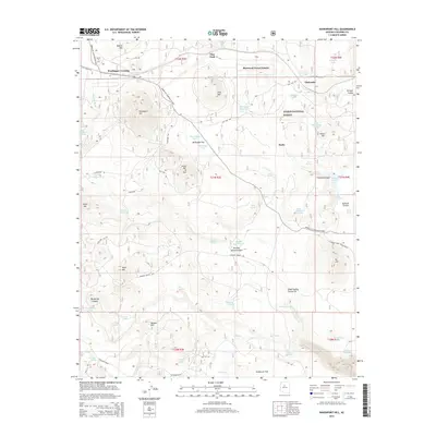
2014 Map of Davenport Hill
USGS Topo · Published 2014About this map
Kaibab National Forest dominates this Coconino County landscape, where the high-altitude terrain of the Colorado Plateau is marked by volcanic features and critical water management. The community of Parks and the settlement at Chalender sit along a historic transportation corridor, while residential developments like Sherwood Forest Estates appear amidst the timber. The map details an extensive network of named tanks and springs, such as Pouquette Homestead Tank and Scholz Lake, which have historically supported ranching and homesteading efforts in an arid environment. Landforms including Davenport Hill, Boxcar Hill, and Seven Bar K Hill break the expanse of McDougal Flat and Garland Prairie. From the vista at Sycamore Point to the remote Bootlegger Crossing, the survey illustrates the complex geography of forest management and early Arizona settlement patterns.
Find a feature on this map
74 named features on this map. Tap any name to fly to it.
Don’t see what you’re looking for? This feature index may not catch every label — zoom into the map to look around manually.
Map Details
Editions of this 2014 Davenport Hill Map
This is the sole edition of this map. No revisions or reprints were ever made.
Other maps of this area

1886 · San Francisco Mtns
USGS Topo · 1:250,000

1886 · Chino
USGS Topo · 1:250,000

1891 · San Francisco Mtns
USGS Topo · 1:250,000

1891 · Chino
USGS Topo · 1:250,000

1894 · San Francisco Mtns
USGS Topo · 1:250,000

1899 · San Francisco Mtns
USGS Topo · 1:250,000

1908 · Flagstaff
USGS Topo · 1:125,000

1912 · Flagstaff
USGS Topo · 1:125,000

1922 · Williams
USGS Topo · 1:125,000

1947 · Flagstaff
USGS Topo · 1:250,000