2024 Map of Davis
USGS Topo · Published 2024About this map
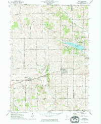
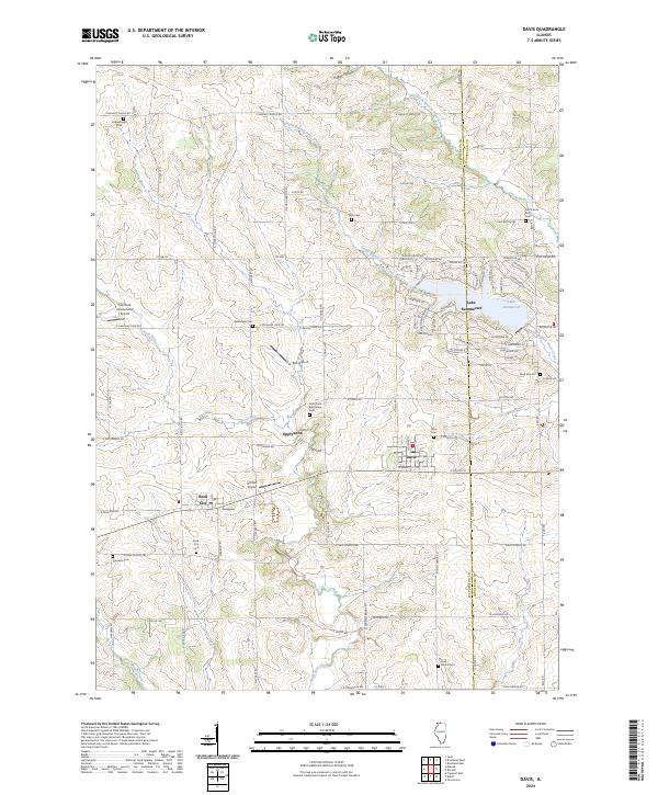
The Davis area of northwestern Illinois is defined by the headwaters of the South Branch Otter Creek and Rock Run, where the agricultural landscape meets the residential development surrounding Lake Summerset. Small unincorporated communities like Epplyanna and Rock City serve as historic nodes in this rural terrain, which is notable for its high density of family and community burial grounds. Genealogists will find a wealth of specific sites to research, including the Saint Pauls Eppleyanna Cem, Pioneers Cem, and Irish Grove Cem. The presence of multiple small airstrips, such as Hillman Airport and Ellis Airport, reflects a distinctive local aviation culture within the farming townships. Moving toward the Winnebago County line, the intricate street network of the Lake Summerset community, with roads like Delburne Dr and Gainsboro Rd, creates a stark visual contrast to the straight section lines of the surrounding countryside.
Find a feature on this map
129 named features on this map. Tap any name to fly to it.
Don’t see what you’re looking for? This feature index may not catch every label — zoom into the map to look around manually.
Map Details
Editions of this 2024 Davis Map
This is the sole edition of this map. No revisions or reprints were ever made.