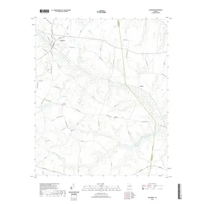
2020 Map of Davisboro
USGS Topo · Published 2020About this map
Davisboro serves as the primary hub in this Georgia landscape, situated in the upper northwest corner where Williamson Swamp Cr begins its winding path through the center of the quadrangle. The terrain is defined by a complex network of wetlands and tributaries, including Steel Creek and Mill Branch, which drain into the main swamp channel. This rural expanse is dotted with community landmarks that speak to generations of local residency, such as Joseys Chapel Cem and New Hope Church Cem, located near the southern reaches of the swamp. Further east, the small settlement of Almira sits near the crossing of the Jefferson and Washington county line. The presence of numerous family-named landmarks like Fulford Cem and recreational spots such as Walnut Br Fishing Lake reflects a long-standing connection between the residents and the surrounding landscape of creeks and lakes.
Find a feature on this map
63 named features on this map. Tap any name to fly to it.
Don’t see what you’re looking for? This feature index may not catch every label — zoom into the map to look around manually.
Map Details
Editions of this 2020 Davisboro Map
This is the sole edition of this map. No revisions or reprints were ever made.
Other maps of this area

1920 · Stapleton
USGS Topo · 1:62,500

1948 · Stapleton
USGS Topo · 1:62,500

1948 · Louisville
USGS Topo · 1:24,000

1950 · Louisville
USGS Topo · 1:24,000

1953 · Athens
USGS Topo · 1:250,000

1957 · Macon
USGS Topo · 1:250,000

1958 · Macon
USGS Topo · 1:250,000

1958 · Athens
USGS Topo · 1:250,000

1959 · Athens
USGS Topo · 1:250,000

1963 · Athens
USGS Topo · 1:250,000