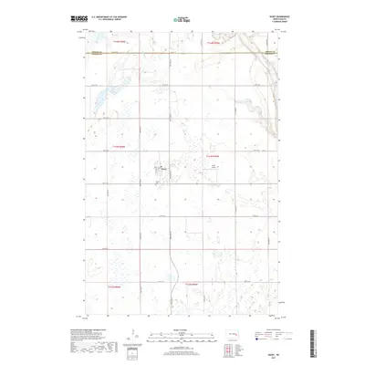
2017 Map of Dazey
USGS Topo · Published 2017About this map
Dazey anchors this corner of the North Dakota prairie, situated at the intersection of a strictly gridded road network that defines the rural landscape of Barnes County. The small settlement is accompanied by the Dazey Cem to the south and Bryn Airport to the east, reflecting the essential infrastructure of a modern agricultural community. The terrain is marked by a high concentration of prairie potholes and small wetlands, which feed into larger water bodies like Lake Benson and Hanson Lake. Along the eastern edge of the quadrangle, the land descends into the valley of Baldhill Creek, where the meandering stream and its tributary Silver Cr contrast with the geometric precision of the township and range survey lines. This landscape demonstrates the enduring influence of the Public Land Survey System on the development of the Great Plains.
Find a feature on this map
22 named features on this map. Tap any name to fly to it.
Don’t see what you’re looking for? This feature index may not catch every label — zoom into the map to look around manually.
Map Details
Editions of this 2017 Dazey Map
This is the sole edition of this map. No revisions or reprints were ever made.
Other maps of this area

1952 · New Rockford
USGS Topo · 1:250,000

1956 · New Rockford
USGS Topo · 1:250,000

1961 · Leal
USGS Topo · 1:24,000

1961 · Baldhill Dam
USGS Topo · 1:24,000

1961 · Revere
USGS Topo · 1:24,000

1961 · Hannaford
USGS Topo · 1:24,000

1961 · Wimbledon NE
USGS Topo · 1:24,000

1961 · Rogers
USGS Topo · 1:24,000

1961 · Dazey NE
USGS Topo · 1:24,000

1961 · Dazey
USGS Topo · 1:24,000