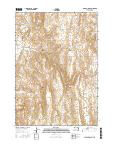
2017 Map of De Armond Mountain
USGS Topo · Published 2017About this map
De Armond Mountain and Bendire Mtn dominate this high-desert reach of Malheur County, where the landscape is defined by an extensive network of springs and man-made water storage. The terrain is marked by significant elevation changes, from the deep cuts of Whitley Canyon and Slaughter Gulch to the elevated expanse of Lake Ridge and Big Flat. The distribution of water resources is dense for such an arid region, featuring numerous named catchments like Murphy Reservoir, Goldy Reservoir, and the Warm Springs Reservoir in the southeast. Ranching and land management infrastructure is evident through the naming of localized features such as Rattlesnake Spring, Munkers Spring, and Indian Spring, which likely served as vital watering holes. Navigation through this isolated country relies on the north-south corridors of Bendire Rd and Willow Basin Rd, which provide access to the various reservoirs and springs scattered across the township lines.
Find a feature on this map
40 named features on this map. Tap any name to fly to it.
Don’t see what you’re looking for? This feature index may not catch every label — zoom into the map to look around manually.
Map Details
Editions of this 2017 De Armond Mountain Map
This is the sole edition of this map. No revisions or reprints were ever made.
Other maps of this area

1908 · Ironside Mountain
USGS Topo · 1:125,000

1955 · Baker
USGS Topo · 1:250,000

1955 · Burns
USGS Topo · 1:250,000

1955 · Canyon City
USGS Topo · 1:250,000

1955 · Boise
USGS Topo · 1:250,000

1958 · Burns
USGS Topo · 1:250,000

1958 · Boise
USGS Topo · 1:250,000

1959 · Baker
USGS Topo · 1:250,000

1959 · Burns
USGS Topo · 1:250,000

1959 · Canyon City
USGS Topo · 1:250,000