
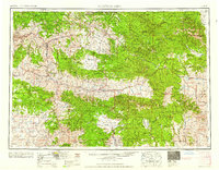
1959 Map of Canyon City
USGS Topo · Published 1959About this map
The Blue Mountains dominate the high-altitude landscape of Eastern Oregon in the late 1950s, a period when the timber and ranching industries shaped local infrastructure. Centered on Canyon City and the neighboring town of John Day, this survey documents a network of isolated settlements and mountain outposts. The winding course of the John Day River and its various forks provide the primary corridors for travel, while the extensive boundaries of the Malheur National Forest and Whitman National Forest underscore the region's reliance on public lands. Significant industrial shifts are evident in the marking of the Sumpter Valley RR (Abandoned), illustrating the decline of early narrow-gauge rail lines that once served the gold mines and sawmills of Sumpter. From the cattle ranges of Bear Valley to the geological landmarks of John Day Fossil Beds State Park, the map captures the transition from frontier extraction to mid-century resource management.
Find a feature on this map
127 named features on this map. Tap any name to fly to it.
Don’t see what you’re looking for? This feature index may not catch every label — zoom into the map to look around manually.
Map Details
Editions of this 1959 Canyon City Map
2 editions found
Other maps of this area

1901 · Baker City
USGS Topo · 1:125,000

1901 · Sumpter
USGS Topo · 1:125,000

1906 · Telocaset
USGS Topo · 1:125,000

1908 · Ironside Mountain
USGS Topo · 1:125,000

1916 · Condon
USGS Topo · 1:125,000

1926 · Mitchell
USGS Topo · 1:125,000

1932 · Dayville
USGS Topo · 1:125,000

1936 · Dayville
USGS Topo · 1:125,000

1940 · Mount Vernon
USGS Topo · 1:62,500

1940 · Aldrich Mtn.
USGS Topo · 1:62,500