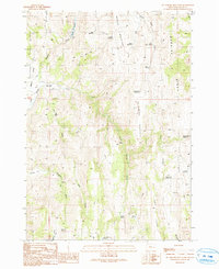
1990 Map of De Armond Mountain
USGS Topo · Published 1991About this map
Ben Dire Mountain and De Armond Mountain dominate this corner of Malheur County, where the landscape is defined by a complex network of high ridges and water management features. The distribution of small-scale impoundments like Murphy Reservoir, Table Reservoir, and Goldy Reservoir suggests a pastoral economy reliant on seasonal water storage across the high desert terrain. Notable geographic markers such as Poverty Flat and Slaughter Gulch provide a window into the character of local toponymy from the era of early ranching. While most transit is limited to unpaved routes, a historical Pack Trail is traced across the northern slopes of Ben Dire Ridge, linking the Willow Basin Creek drainage to the interior highlands. To the south, Warm Springs Reservoir and Angel Wells Reservoir mark the edge of the more significant water basins in this arid region.
Find a feature on this map
33 named features on this map. Tap any name to fly to it.
Don’t see what you’re looking for? This feature index may not catch every label — zoom into the map to look around manually.
Map Details
Editions of this 1990 De Armond Mountain Map
This is the sole edition of this map. No revisions or reprints were ever made.
Other maps of this area

1908 · Ironside Mountain
USGS Topo · 1:125,000

1955 · Baker
USGS Topo · 1:250,000

1955 · Burns
USGS Topo · 1:250,000

1955 · Canyon City
USGS Topo · 1:250,000

1955 · Boise
USGS Topo · 1:250,000

1958 · Burns
USGS Topo · 1:250,000

1958 · Boise
USGS Topo · 1:250,000

1959 · Baker
USGS Topo · 1:250,000

1959 · Burns
USGS Topo · 1:250,000

1959 · Canyon City
USGS Topo · 1:250,000