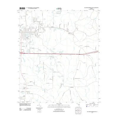
2012 Map of De Funiak Springs East
USGS Topo · Published 2012About this map
Eucheeanna and the eastern reaches of DeFuniak Springs define this Walton County landscape, where the flatlands of the Florida Panhandle are etched by an intricate network of creeks and small ponds. The circular Lake DeFuniak sits at the western edge of the sheet, serving as the center of a grid-style settlement that transitions into the rural communities of Argyle, Walcan, and Koerber to the east. This 2012 survey illustrates the area's development around transportation corridors and aviation, with Turner Farms Airport and Cuchens Airport situated near the headwaters of Blount Cr.
Find a feature on this map
137 named features on this map. Tap any name to fly to it.
Don’t see what you’re looking for? This feature index may not catch every label — zoom into the map to look around manually.
Map Details
Editions of this 2012 De Funiak Springs East Map
This is the sole edition of this map. No revisions or reprints were ever made.
Other maps of this area

1935 · De Funiak Springs
USGS Topo · 1:48,000

1938 · De Funiak Springs
USGS Topo · 1:62,500

1948 · Ponce De Leon
USGS Topo · 1:24,000

1949 · Glendale
USGS Topo · 1:62,500

1949 · Redbay
USGS Topo · 1:24,000

1950 · Prosperity
USGS Topo · 1:24,000

1950 · Ponce De Leon
USGS Topo · 1:24,000

1950 · Redbay
USGS Topo · 1:24,000

1951 · Glendale
USGS Topo · 1:62,500

1954 · Tallahassee
USGS Topo · 1:250,000