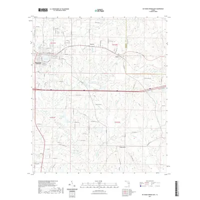
2021 Map of De Funiak Springs East
USGS Topo · Published 2021About this map
De Funiak Springs and the surrounding Walton County countryside are shown here at the start of the 2020s, revealing a landscape defined by its specific water features and historical road networks. The perfectly circular Lake DeFuniak sits at the heart of the settlement, anchored by the Walton County Courthouse. To the east, the rural communities of Argyle, Koerber, and the historically significant Eucheeanna are connected by routes such as the Old Spanish Trl and Koerber Rd. This modern survey details an intricate drainage system including Bruce Cr and Panther Cr, alongside numerous private water bodies like S D Ingram Pond One and C J King Junior Pond. The map also documents the transition from the organized town grid to the sprawling agricultural and wooded lands that extend toward the Walton Co Holmes Co boundary.
Find a feature on this map
119 named features on this map. Tap any name to fly to it.
Don’t see what you’re looking for? This feature index may not catch every label — zoom into the map to look around manually.
Map Details
Editions of this 2021 De Funiak Springs East Map
This is the sole edition of this map. No revisions or reprints were ever made.
Other maps of this area

1935 · De Funiak Springs
USGS Topo · 1:48,000

1938 · De Funiak Springs
USGS Topo · 1:62,500

1948 · Ponce De Leon
USGS Topo · 1:24,000

1949 · Glendale
USGS Topo · 1:62,500

1949 · Redbay
USGS Topo · 1:24,000

1950 · Prosperity
USGS Topo · 1:24,000

1950 · Ponce De Leon
USGS Topo · 1:24,000

1950 · Redbay
USGS Topo · 1:24,000

1951 · Glendale
USGS Topo · 1:62,500

1954 · Tallahassee
USGS Topo · 1:250,000