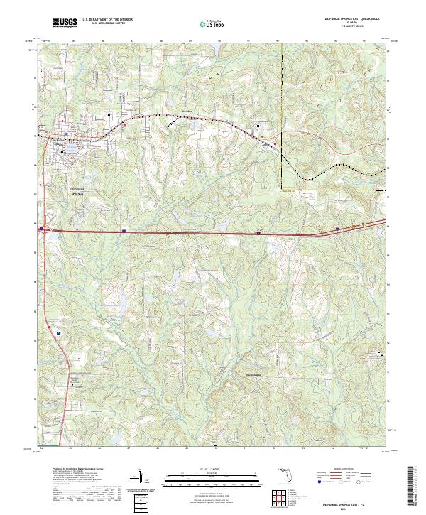
2024 Map of De Funiak Springs East
USGS Topo · Published 2024About this map
De Funiak Springs serves as the focal point of this Walton County survey, centered around the circular geometry of Lake DeFuniak and the Walton County Courthouse. The map documents a landscape where established civic centers meet rural communities such as Argyle and Eucheeanna, the latter situated near the confluence of Long Branch and Euchee Valley Cemetery. This area is characterized by an extensive network of drainage basins, including Bruce Creek and Panther Creek, which crisscross the sandy terrain. Genealogists and local historians will find significant value in the numerous documented burial sites and places of worship, such as the Pleasant Grove Presbyterian Church Cemetery and Woodlawn Baptist Church Cemetery. The map also captures the path of the railroad running parallel to Baldwin Avenue, illustrating the historical transportation corridor that shaped the growth of these North Florida settlements.
Find a feature on this map
135 named features on this map. Tap any name to fly to it.
Don’t see what you’re looking for? This feature index may not catch every label — zoom into the map to look around manually.
Map Details
Editions of this 2024 De Funiak Springs East Map
This is the sole edition of this map. No revisions or reprints were ever made.
Other maps of this area

1935 · De Funiak Springs
USGS Topo · 1:48,000

1938 · De Funiak Springs
USGS Topo · 1:62,500

1948 · Ponce De Leon
USGS Topo · 1:24,000

1949 · Glendale
USGS Topo · 1:62,500

1949 · Redbay
USGS Topo · 1:24,000

1950 · Prosperity
USGS Topo · 1:24,000

1950 · Ponce De Leon
USGS Topo · 1:24,000

1950 · Redbay
USGS Topo · 1:24,000

1951 · Glendale
USGS Topo · 1:62,500

1954 · Tallahassee
USGS Topo · 1:250,000