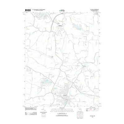
2012 Map of De Soto
USGS Topo · Published 2012About this map
Joachim Creek and its many tributaries define the landscape of central Jefferson County, where the city of De Soto serves as a primary hub. The 2012 layout shows the city's structured street grid situated south of Victoria, while Hillsboro anchors the northern portion of the map. This area is characterized by a high concentration of recreational and residential water bodies, including Lake Wauwanoka, Lake Siesta, and Lake Briarwood, illustrating the mid-century to modern development of suburban lake communities in this part of Missouri. Local genealogists will find several significant burial sites documented, such as Calvary Cemetery, Victoria Cemetery, and Good Shepherd Cemetery. Traditional place names like Shepley Hollow and Possum Holler persist alongside newer developments like the Hickory Hills Golf Club Lake, reflecting a transition from rural topography to more modern recreational land use.
Find a feature on this map
151 named features on this map. Tap any name to fly to it.
Don’t see what you’re looking for? This feature index may not catch every label — zoom into the map to look around manually.
Map Details
Editions of this 2012 De Soto Map
This is the sole edition of this map. No revisions or reprints were ever made.
Other maps of this area

1901 · De Soto
USGS Topo · 1:125,000

1912 · Kimmswick
USGS Topo · 1:62,500

1915 · Crystal City
USGS Topo · 1:62,500

1916 · Kimmswick
USGS Topo · 1:62,500

1930 · De Soto NE
USGS Topo · 1:24,000

1930 · Pacific SE
USGS Topo · 1:24,000

1931 · De Soto SE
USGS Topo · 1:24,000

1937 · Fletcher
USGS Topo · 1:24,000

1937 · Tiff
USGS Topo · 1:24,000

1938 · Cedar Hill
USGS Topo · 1:24,000