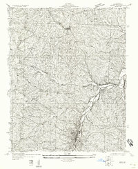
1958 Map of De Soto NE
USGS Topo · Published 1958About this map
Joachim Creek and Plattin Creek carve deep valleys through this portion of Jefferson County, defining the settlement patterns of the early twentieth century. The industrial and transit corridor is dominated by the Missouri Pacific railroad, which links the communities of Festus, Hematite, and Plattin. This survey, compiled in part from aerial photographs taken by the U.S. Army Air Corps, captures a rural landscape where local education was still centered on decentralized landmarks like Haverstick Sch, Moore Sch, and Buckie Sch. The terrain is marked by numerous small tributaries such as Tanyard Branch and Cather Creek, while various Cem sites and the Second Sch provide essential touchpoints for genealogical research. The alignment of State Highway No 21 and the presence of a significant Pipe Line running through the northern sections illustrate the region's infrastructure as it stood before mid-century modernization.
Find a feature on this map
28 named features on this map. Tap any name to fly to it.
Don’t see what you’re looking for? This feature index may not catch every label — zoom into the map to look around manually.
Map Details
Editions of this 1958 De Soto NE Map
This is the sole edition of this map. No revisions or reprints were ever made.
Other maps of this area

1901 · De Soto
USGS Topo · 1:125,000

1912 · Kimmswick
USGS Topo · 1:62,500

1915 · Crystal City
USGS Topo · 1:62,500

1916 · Kimmswick
USGS Topo · 1:62,500

1930 · De Soto NE
USGS Topo · 1:24,000

1930 · Pacific SE
USGS Topo · 1:24,000

1931 · De Soto SE
USGS Topo · 1:24,000

1937 · Fletcher
USGS Topo · 1:24,000

1937 · Tiff
USGS Topo · 1:24,000

1938 · Cedar Hill
USGS Topo · 1:24,000