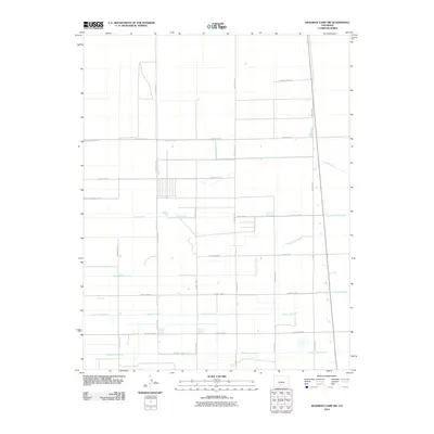
2010 Map of Deadman Camp SW
USGS Topo · Published 2010About this map
Agricultural water management and a rigid grid of rural roads define this high-altitude landscape in Colorado. The terrain is structured by a sophisticated irrigation network, with the prominent Farmers Union Canal and Gibson Ditch serving as primary arteries for the region's ranching and farming operations. Smaller distribution channels like the North Lateral and Lateral Fortyseven create a geometric pattern of water transport that dictates land use across the quadrangle. The map reflects a modern period of organized land parcels, where transportation is almost exclusively limited to a numbered grid of county routes, such as County Road G and County Rd-57, which provide access to the dispersed homesteads and fields. This map offers a clear look at the intersection of water rights and rural development in Saguache County.
Find a feature on this map
19 named features on this map. Tap any name to fly to it.
Don’t see what you’re looking for? This feature index may not catch every label — zoom into the map to look around manually.
Map Details
Editions of this 2010 Deadman Camp SW Map
This is the sole edition of this map. No revisions or reprints were ever made.
Other maps of this area

1915 · Del Norte
USGS Topo · 1:125,000

1917 · Del Norte
USGS Topo · 1:125,000

1945 · Durango
USGS Topo · 1:250,000

1953 · Durango
USGS Topo · 1:250,000

1954 · Durango
USGS Topo · 1:250,000

1954 · Trinidad
USGS Topo · 1:250,000

1955 · Trinidad
USGS Topo · 1:250,000

1958 · Trinidad
USGS Topo · 1:250,000

1959 · Trinidad
USGS Topo · 1:250,000

1961 · Durango
USGS Topo · 1:250,000