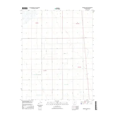
2016 Map of Deadman Camp SW
USGS Topo · Published 2016About this map
Farmers Union Canal and the Gibson Ditch define the agricultural water management of this high-altitude landscape in Saguache County. This 2016 survey shows a strictly rectilinear grid of rural routes, including Co RD 57 and Co RD G, which navigate the San Luis Valley's vast open stretches. The infrastructure is characterized by an extensive system of secondary irrigation channels such as the N Lateral, N Central Lateral, and Lateral Fortyseven. These features indicate a highly organized land-use pattern centered on controlled water distribution. Local naming, seen in roads like Peppers Ln and Holly Dr, provides a human scale to the large-scale township and range divisions of t42n r9e and t41n r10e.
Find a feature on this map
25 named features on this map. Tap any name to fly to it.
Don’t see what you’re looking for? This feature index may not catch every label — zoom into the map to look around manually.
Map Details
Editions of this 2016 Deadman Camp SW Map
This is the sole edition of this map. No revisions or reprints were ever made.
Other maps of this area

1915 · Del Norte
USGS Topo · 1:125,000

1917 · Del Norte
USGS Topo · 1:125,000

1945 · Durango
USGS Topo · 1:250,000

1953 · Durango
USGS Topo · 1:250,000

1954 · Durango
USGS Topo · 1:250,000

1954 · Trinidad
USGS Topo · 1:250,000

1955 · Trinidad
USGS Topo · 1:250,000

1958 · Trinidad
USGS Topo · 1:250,000

1959 · Trinidad
USGS Topo · 1:250,000

1961 · Durango
USGS Topo · 1:250,000