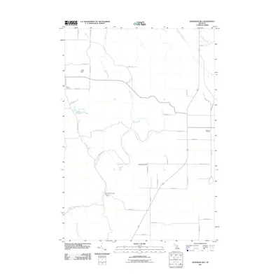
2011 Map of Deadmans Hill
USGS Topo · Published 2011About this map
Deadmans Hill provides a dramatic vantage point over the glacial valley of the Jordan River in Charlevoix County. This 2011 survey documents a landscape defined by significant conservation and water management efforts, anchored by the Jordan River National Fish Hatchery in the southern valley. The terrain is deeply carved by numerous tributaries, including Warner Creek, Eaton Creek, and Section Thirteen Creek, which feed the river system as it winds through the interior.
Find a feature on this map
38 named features on this map. Tap any name to fly to it.
Don’t see what you’re looking for? This feature index may not catch every label — zoom into the map to look around manually.
Map Details
Editions of this 2011 Deadmans Hill Map
This is the sole edition of this map. No revisions or reprints were ever made.
Other maps of this area

1954 · Traverse City
USGS Topo · 1:250,000

1955 · Cheboygan
USGS Topo · 1:250,000

1956 · Alba
USGS Topo · 1:62,500

1956 · Mancelona
USGS Topo · 1:62,500

1958 · Cheboygan
USGS Topo · 1:250,000

1958 · Traverse City
USGS Topo · 1:250,000

1961 · Boyne Falls
USGS Topo · 1:62,500

1961 · Boyne City
USGS Topo · 1:62,500

1975 · Mancelona NE
USGS Topo · 1:24,000

1975 · Boyne City NE
USGS Topo · 1:24,000
Featured Places
- Wilson Township, MI
- Warner Township, MI
- Chestonia Township, MI
- Jordan Township, MI
- Boyne Valley Township, MI