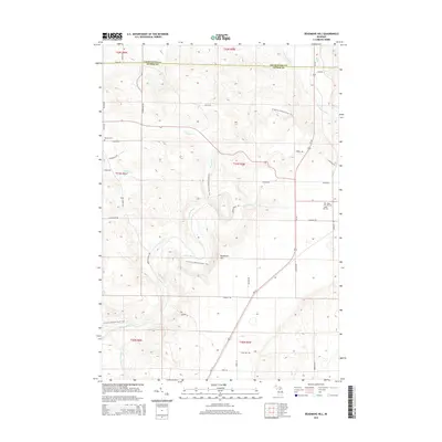
2014 Map of Deadmans Hill
USGS Topo · Published 2014About this map
The Jordan River winds through this northern Michigan landscape, carving a deep valley that defines the local topography. This 2014 survey captures a region where the Charlevoix Co and Antrim Co border intersects with a network of rural roads and protected recreation corridors. The N Country National Scenic Trail traverses the central terrain, passing near the prominent elevation of Deadmans Hill. Smaller watercourses like Warner Cr and Moyer Cr drain the high ground, while Marsh Ponds sit to the west. For those interested in local heritage, the map identifies small, established burial grounds such as Brown Cem and Maple Hill Cem. The area maintains its rural character with a grid of local roads, including Pesek Rd and Francis Rd, which navigate the elevation changes between the river forks.
Find a feature on this map
46 named features on this map. Tap any name to fly to it.
Don’t see what you’re looking for? This feature index may not catch every label — zoom into the map to look around manually.
Map Details
Editions of this 2014 Deadmans Hill Map
This is the sole edition of this map. No revisions or reprints were ever made.
Other maps of this area

1954 · Traverse City
USGS Topo · 1:250,000

1955 · Cheboygan
USGS Topo · 1:250,000

1956 · Alba
USGS Topo · 1:62,500

1956 · Mancelona
USGS Topo · 1:62,500

1958 · Cheboygan
USGS Topo · 1:250,000

1958 · Traverse City
USGS Topo · 1:250,000

1961 · Boyne Falls
USGS Topo · 1:62,500

1961 · Boyne City
USGS Topo · 1:62,500

1975 · Mancelona NE
USGS Topo · 1:24,000

1975 · Boyne City NE
USGS Topo · 1:24,000
Featured Places
- Wilson Township, MI
- Warner Township, MI
- Chestonia Township, MI
- Jordan Township, MI
- Boyne Valley Township, MI