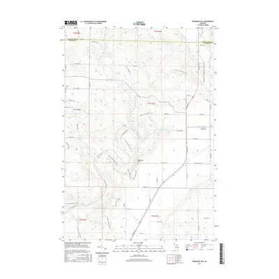
2017 Map of Deadmans Hill
USGS Topo · Published 2017About this map
The Jordan River corridor defines the landscape of this northern Michigan region, cutting a winding path through the borderlands of Charlevoix and Antrim counties. This 2017 survey highlights a heavily forested and topographically diverse area where the high ground at Deadmans Hill overlooks the valley below. The land is crisscrossed by an extensive network of recreational routes, including the N Country National Scenic Trail, the Jordan Valley Pathway, and the Warner Creek Pathway, indicating the area's modern identity as a protected wilderness and recreation hub.
Find a feature on this map
58 named features on this map. Tap any name to fly to it.
Don’t see what you’re looking for? This feature index may not catch every label — zoom into the map to look around manually.
Map Details
Editions of this 2017 Deadmans Hill Map
This is the sole edition of this map. No revisions or reprints were ever made.
Other maps of this area

1954 · Traverse City
USGS Topo · 1:250,000

1955 · Cheboygan
USGS Topo · 1:250,000

1956 · Alba
USGS Topo · 1:62,500

1956 · Mancelona
USGS Topo · 1:62,500

1958 · Cheboygan
USGS Topo · 1:250,000

1958 · Traverse City
USGS Topo · 1:250,000

1961 · Boyne Falls
USGS Topo · 1:62,500

1961 · Boyne City
USGS Topo · 1:62,500

1975 · Mancelona NE
USGS Topo · 1:24,000

1975 · Boyne City NE
USGS Topo · 1:24,000
Featured Places
- Wilson Township, MI
- Warner Township, MI
- Chestonia Township, MI
- Jordan Township, MI
- Boyne Valley Township, MI