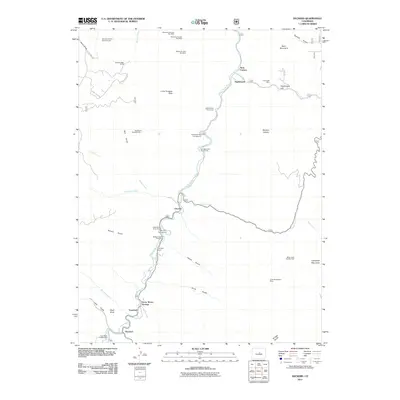
2011 Map of Deckers
USGS Topo · Published 2011About this map
Deckers and Trumbull sit along the winding corridor of the South Platte River, serving as focal points for this mountain landscape at the beginning of the 21st century. The map illustrates a region defined by its narrow river valleys and high ridges, where small riverside settlements like Oxyoke and Nighthawk are connected by S Platte River Rd. A clear pattern of legacy resource extraction is evident through numerous named mining claims, including the Big Bertha Pegmatite Mine and the Three Musketeers Mine tucked into the gulches. Historically significant sites such as Long Scraggy Ranch and Swayback Ranch are interspersed with recreational areas like the Ponderosa Pine Campground, reflecting the area's shift from industrial roots toward land conservation and mountain tourism. Prominent topographical landmarks including Long Scraggy Peak, Bear Mountain, and Campbell Mountain frame the various drainages of Sugar Creek and Pine Creek.
Find a feature on this map
51 named features on this map. Tap any name to fly to it.
Don’t see what you’re looking for? This feature index may not catch every label — zoom into the map to look around manually.
Map Details
Editions of this 2011 Deckers Map
This is the sole edition of this map. No revisions or reprints were ever made.
Other maps of this area

1893 · Platte Canyon
USGS Topo · 1:125,000

1945 · Platte Canyon
USGS Topo · 1:24,000

1945 · Pine
USGS Topo · 1:24,000

1945 · Kassler
USGS Topo · 1:24,000

1948 · Kassler
USGS Topo · 1:24,000

1948 · Pine
USGS Topo · 1:24,000

1948 · Platte Canyon
USGS Topo · 1:24,000

1953 · Denver
USGS Topo · 1:250,000

1954 · Devils Head
USGS Topo · 1:24,000

1954 · Deckers
USGS Topo · 1:24,000