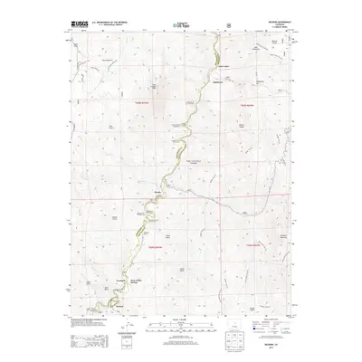
2013 Map of Deckers
USGS Topo · Published 2013About this map
The South Platte River carves a central path through this portion of the Pike National Forest, defining the settlement patterns of the early 21st century. Small communities and outposts such as Deckers, Trumbull, and Nighthawk are concentrated along the river corridor and the winding route of Co-67. The geography is characterized by numerous steep gulches, including Saloon Gulch, Hatch Gulch, and Jenny Gulch, which drain the surrounding highlands toward the river valley.
Find a feature on this map
57 named features on this map. Tap any name to fly to it.
Don’t see what you’re looking for? This feature index may not catch every label — zoom into the map to look around manually.
Map Details
Editions of this 2013 Deckers Map
This is the sole edition of this map. No revisions or reprints were ever made.
Other maps of this area

1893 · Platte Canyon
USGS Topo · 1:125,000

1945 · Platte Canyon
USGS Topo · 1:24,000

1945 · Pine
USGS Topo · 1:24,000

1945 · Kassler
USGS Topo · 1:24,000

1948 · Kassler
USGS Topo · 1:24,000

1948 · Pine
USGS Topo · 1:24,000

1948 · Platte Canyon
USGS Topo · 1:24,000

1953 · Denver
USGS Topo · 1:250,000

1954 · Devils Head
USGS Topo · 1:24,000

1954 · Deckers
USGS Topo · 1:24,000