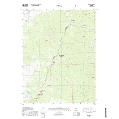
2019 Map of Deckers
USGS Topo · Published 2019About this map
The South Platte River carves a central path through this portion of the Pike National Forest, where the border between Jefferson and Douglas counties follows the river's winding course. Small settlements and points of interest are concentrated along the valley floor, including Deckers, Trumbull, and Oxyoke. These locations, connected by S Platte River Rd, serve as focal points in a landscape dominated by dramatic granite formations and deep drainages. High points such as Long Scraggy Peak and Noddle Heads overlook a network of named gulches, including Saloon Gulch and Bridge Gulch. To the south, the topography rises toward Turtle Mountain, while Snow Water Springs provides a distinct hydrological marker near the riverbank. This map documents the rural character of the Front Range foothills, where topography dictates the narrow corridor of habitation and transport.
Find a feature on this map
39 named features on this map. Tap any name to fly to it.
Don’t see what you’re looking for? This feature index may not catch every label — zoom into the map to look around manually.
Map Details
Editions of this 2019 Deckers Map
This is the sole edition of this map. No revisions or reprints were ever made.
Other maps of this area

1893 · Platte Canyon
USGS Topo · 1:125,000

1945 · Platte Canyon
USGS Topo · 1:24,000

1945 · Pine
USGS Topo · 1:24,000

1945 · Kassler
USGS Topo · 1:24,000

1948 · Kassler
USGS Topo · 1:24,000

1948 · Pine
USGS Topo · 1:24,000

1948 · Platte Canyon
USGS Topo · 1:24,000

1953 · Denver
USGS Topo · 1:250,000

1954 · Devils Head
USGS Topo · 1:24,000

1954 · Deckers
USGS Topo · 1:24,000