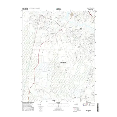
2016 Map of Deep Creek
USGS Topo · Published 2016About this map
Deep Creek serves as a historic nexus where the Southern Branch Elizabeth River meets the Dismal Swamp Canal, a landscape defined by the intersection of early colonial water routes and modern expansion. This survey captures a region transitioning from the wetlands of the Great Dismal Swamp and Green Sea to developed communities like Grassfield and Bells Mill. Notable landmarks include the Chesapeake Regional Airport and the Tidewater Community Coll Chesapeake Campus, marking the northward reach of local infrastructure. To the south, rural settlements such as Cornland, Benefit, and West Landing persist near the edge of the marshes, while the Intracoastal Waterway remains a critical artery for maritime transit. The presence of Berea Memorial Cem and Good Hope Cem provides specific points of interest for those researching the genealogical history of the area.
Find a feature on this map
167 named features on this map. Tap any name to fly to it.
Don’t see what you’re looking for? This feature index may not catch every label — zoom into the map to look around manually.
Map Details
Editions of this 2016 Deep Creek Map
This is the sole edition of this map. No revisions or reprints were ever made.
Other maps of this area

1907 · Norfolk
USGS Topo · 1:125,000

1918 · Cape Henry
USGS Topo · 1:62,500

1919 · Cape Henry
USGS Topo · 1:62,500

1921 · Newport News
USGS Topo · 1:62,500

1939 · Moyock
USGS Topo · 1:62,500

1940 · Lake Drummond
USGS Topo · 1:62,500

1944 · Norfolk South
USGS Topo · 1:25,000

1945 · Lake Drummond
USGS Topo · 1:62,500

1946 · Moyock
USGS Topo · 1:62,500

1948 · Norfolk South
USGS Topo · 1:24,000