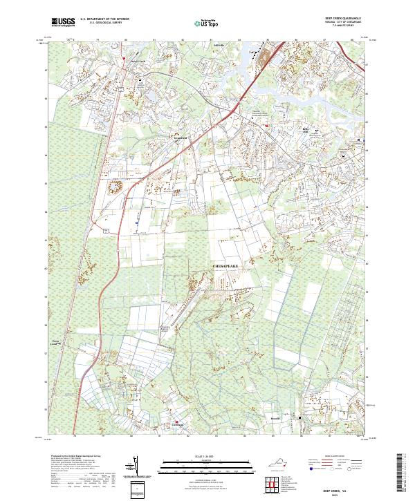
2022 Map of Deep Creek
USGS Topo · Published 2022About this map
The Great Dismal Swamp dominates the western half of this landscape, its managed hydrology defined by the Dismal Swamp Canal and the Intracoastal Waterway. This area has long served as a critical nexus for transit and commerce between the Virginia coast and the North Carolina interior. To the east, the Southern Branch Elizabeth River winds past industrial and residential pockets like Bells Mill and Millville. The map captures the administrative and educational heart of the city of Chesapeake, featuring the Chesapeake City Courthouse and the Tidewater Community College-Chesapeake Campus. Significant for genealogists are the family and community burial grounds scattered throughout, including the Sergeant March Corprew Family Cem and Good Hope Cem. The transition from the dense, saturated terrain of Green Sea to the developing corridors around Grassfield illustrates the unique environmental and urban balance of this coastal region.
Find a feature on this map
201 named features on this map. Tap any name to fly to it.
Don’t see what you’re looking for? This feature index may not catch every label — zoom into the map to look around manually.
Map Details
Editions of this 2022 Deep Creek Map
This is the sole edition of this map. No revisions or reprints were ever made.
Other maps of this area

1907 · Norfolk
USGS Topo · 1:125,000

1918 · Cape Henry
USGS Topo · 1:62,500

1919 · Cape Henry
USGS Topo · 1:62,500

1921 · Newport News
USGS Topo · 1:62,500

1939 · Moyock
USGS Topo · 1:62,500

1940 · Lake Drummond
USGS Topo · 1:62,500

1944 · Norfolk South
USGS Topo · 1:25,000

1945 · Lake Drummond
USGS Topo · 1:62,500

1946 · Moyock
USGS Topo · 1:62,500

1948 · Norfolk South
USGS Topo · 1:24,000