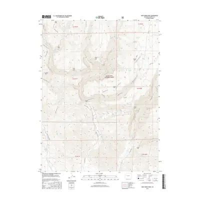
2016 Map of Deep Creek Point
USGS Topo · Published 2016About this map
White River National Forest lands dominate this high-elevation landscape in Garfield County, where deep drainages and prominent mesas define the local topography. This 2016 survey captures a network of backcountry access points including the Clinetop Cow Camp Trail and the Hadley Gulch Trail, which navigate the steep descent from Clinetop Mesa down toward Main Elk Cr. The map shows a region shaped by its water sources, with numerous named springs such as Bear Spring, Prospect Spring, and Joe Hill Spring supporting the wilderness area. High points like Deep Creek Point and Meadow Creek Point provide vantage points over the complex system of basins and gulches. The presence of the Mansfield Ditch Trail indicates managed water infrastructure winding through the difficult terrain of Calhoun Basin.
Find a feature on this map
76 named features on this map. Tap any name to fly to it.
Don’t see what you’re looking for? This feature index may not catch every label — zoom into the map to look around manually.
Map Details
Editions of this 2016 Deep Creek Point Map
This is the sole edition of this map. No revisions or reprints were ever made.
Other maps of this area

1906 · Grand Hogback
USGS Topo · 1:125,000

1910 · Grand Hogback
USGS Topo · 1:125,000

1927 · Glenwood Springs
USGS Topo · 1:125,000

1930 · Glenwood Springs
USGS Topo · 1:125,000

1957 · Leadville
USGS Topo · 1:250,000

1959 · Leadville
USGS Topo · 1:250,000

1960 · Leadville
USGS Topo · 1:250,000

1962 · Leadville
USGS Topo · 1:250,000

1962 · New Castle
USGS Topo · 1:24,000

1962 · Storm King Mountain
USGS Topo · 1:24,000