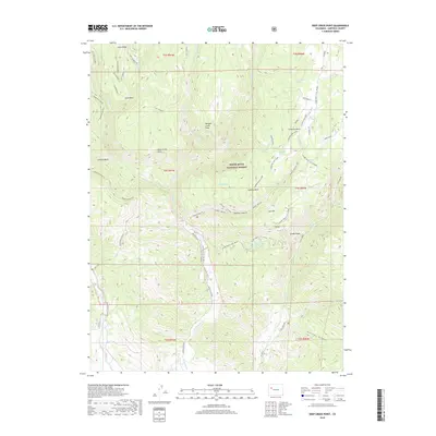
2019 Map of Deep Creek Point
USGS Topo · Published 2019About this map
White River National Forest defines the high-altitude landscape of this Garfield County region, where the steep canyons and plateaus of the Flatops area are meticulously documented. This 2019 survey captures a network of resource management and seasonal access, including the Mansfield Ditch which traverses complex terrain near Calhoun Basin. The map illustrates a landscape shaped by water and elevation, marked by numerous named water sources such as Buttermilk Spring, Bear Spring, and Prospect Spring that support the high-country ecology. High points like Clinetop Mesa and Hadley Point offer significant vantage points over the drainage basins of Main Elk Cr and Deep Cr. Traces of land use are evident in the presence of the Clinetop Cow Camp and the winding Cline Top C1-A1L (Snow) trail, reflecting the area's history of cattle ranching and winter recreation.
Find a feature on this map
43 named features on this map. Tap any name to fly to it.
Don’t see what you’re looking for? This feature index may not catch every label — zoom into the map to look around manually.
Map Details
Editions of this 2019 Deep Creek Point Map
This is the sole edition of this map. No revisions or reprints were ever made.
Other maps of this area

1906 · Grand Hogback
USGS Topo · 1:125,000

1910 · Grand Hogback
USGS Topo · 1:125,000

1927 · Glenwood Springs
USGS Topo · 1:125,000

1930 · Glenwood Springs
USGS Topo · 1:125,000

1957 · Leadville
USGS Topo · 1:250,000

1959 · Leadville
USGS Topo · 1:250,000

1960 · Leadville
USGS Topo · 1:250,000

1962 · Leadville
USGS Topo · 1:250,000

1962 · New Castle
USGS Topo · 1:24,000

1962 · Storm King Mountain
USGS Topo · 1:24,000