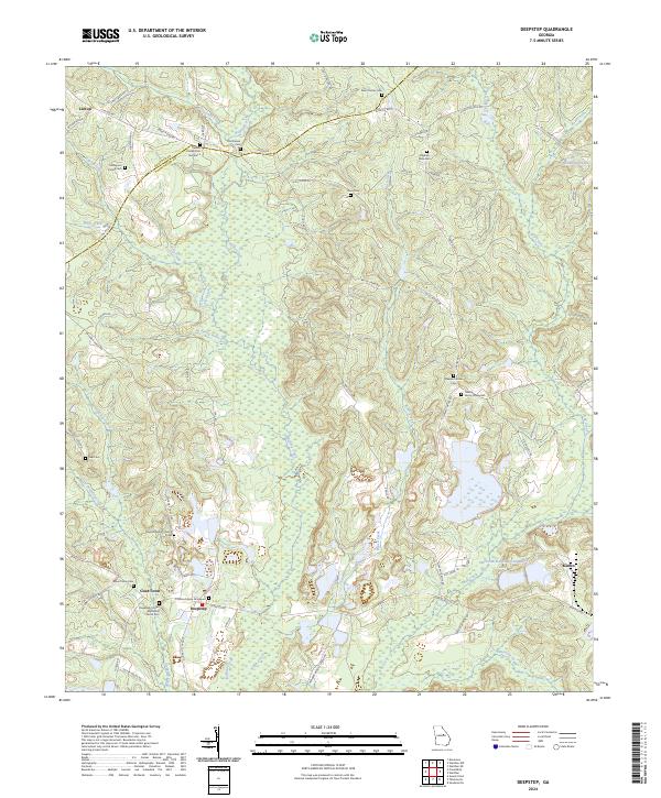
2024 Map of Deepstep
USGS Topo · Published 2024About this map
The boundary between Hancock Co and Washington Co bisects this landscape, which is defined by the extensive wetlands and winding tributaries of Buffalo Creek. This area of Georgia's central interior is characterized by its legacy of small, family-centered rural communities and ancestral landholdings. The map reveals a dense concentration of family cemeteries, including the Thompson Family Cem, Trawick Family Cem Number 2, and Stephen Mills Cem, which point to generations of agricultural settlement and local genealogy.
Find a feature on this map
70 named features on this map. Tap any name to fly to it.
Don’t see what you’re looking for? This feature index may not catch every label — zoom into the map to look around manually.
Map Details
Editions of this 2024 Deepstep Map
This is the sole edition of this map. No revisions or reprints were ever made.
Other maps of this area

1912 · Milledgeville
USGS Topo · 1:62,500

1916 · Irwinton
USGS Topo · 1:62,500

1920 · Irwinton
USGS Topo · 1:62,500

1953 · Athens
USGS Topo · 1:250,000

1957 · Macon
USGS Topo · 1:250,000

1958 · Macon
USGS Topo · 1:250,000

1958 · Athens
USGS Topo · 1:250,000

1959 · Athens
USGS Topo · 1:250,000

1960 · Warthen NE
USGS Topo · 1:24,000

1961 · Deepstep
USGS Topo · 1:24,000