
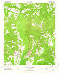
1961 Map of Deepstep
USGS Topo · Published 1963About this map
Buffalo Creek and its many tributaries, including Tiger Creek and Keg Creek, carve a complex drainage pattern across this section of Washington and Hancock counties. The landscape is defined by the early extractive industries of the 1960s, evidenced by the Strip Mine and multiple Claypit sites near Deepstep. These industrial features sit alongside a well-established network of rural community centers such as Linton and Goat Town. Local genealogy is deeply rooted here, with numerous small burial grounds and congregations like Old Darien Cemetery and Smyrna Church distributed throughout the woodland. Educational history is represented by the Deepstep School and Mt Sinai School, while the Renfroe Lookout Tower stands as a prominent high-point landmark over the surrounding terrain. The transition between the namesake settlement and the industrial Kaolin area highlights the region's reliance on mineral resources.
Find a feature on this map
34 named features on this map. Tap any name to fly to it.
Don’t see what you’re looking for? This feature index may not catch every label — zoom into the map to look around manually.
Map Details
Editions of this 1961 Deepstep Map
3 editions found
Other maps of this area

1912 · Milledgeville
USGS Topo · 1:62,500

1916 · Irwinton
USGS Topo · 1:62,500

1920 · Irwinton
USGS Topo · 1:62,500

1953 · Athens
USGS Topo · 1:250,000

1957 · Macon
USGS Topo · 1:250,000

1958 · Macon
USGS Topo · 1:250,000

1958 · Athens
USGS Topo · 1:250,000

1959 · Athens
USGS Topo · 1:250,000

1960 · Warthen NE
USGS Topo · 1:24,000

1961 · Warthen
USGS Topo · 1:24,000