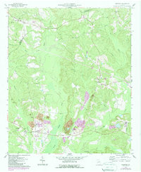
1961 Map of Deepstep
USGS Topo · Published 1987About this map
Linton and Deepstep anchor this agricultural and industrial landscape in central Georgia, where the geography is defined by the headwaters of Buffalo Creek and Keg Creek. The map reveals a transition into the mid-20th-century extraction economy, notably marked by a large Claypit and the settlement of Kaolin in the southeast, indicating the region's significance in kaolin clay mining. Cultural landmarks are densely scattered across the rural tracts, including numerous country churches like Old Darien Ch and Smyrna Ch, alongside small family burial grounds such as Stephen Mills Cem and Trawich Cem. On higher ground, the Renfroe Lookout Tower overlooks the wooded drainages of Brush Creek and Deepstep Creek. The 1980s photorevisions, shown in purple, document evolving land use and industrial expansion near the Strip Mine areas, providing a clear comparison of the changing terrain between the late 1950s and the 1980s.
Find a feature on this map
34 named features on this map. Tap any name to fly to it.
Don’t see what you’re looking for? This feature index may not catch every label — zoom into the map to look around manually.
Map Details
Editions of this 1961 Deepstep Map
3 editions found
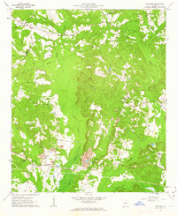
Other maps of this area

1912 · Milledgeville
USGS Topo · 1:62,500

1916 · Irwinton
USGS Topo · 1:62,500

1920 · Irwinton
USGS Topo · 1:62,500

1953 · Athens
USGS Topo · 1:250,000

1957 · Macon
USGS Topo · 1:250,000

1958 · Macon
USGS Topo · 1:250,000

1958 · Athens
USGS Topo · 1:250,000

1959 · Athens
USGS Topo · 1:250,000

1960 · Warthen NE
USGS Topo · 1:24,000

1961 · Deepstep
USGS Topo · 1:24,000