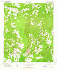
1961 Map of Deepstep
USGS Topo · Published 1963About this map
The boundary between Hancock and Washington counties serves as the backdrop for this early 1960s landscape, where small rural communities are connected by a network of creeks and unimproved roads. The settlement of Deepstep and the smaller Goat Town are central to the southern portion of the sheet, anchored by civic landmarks like the Deepstep School and Mt Sinai Church. The terrain is deeply etched by watercourses such as Buffalo Creek and Swift Creek, while the local economy is visibly shaped by industrial activity including a Strip Mine and multiple claypits near Kaolin.
Find a feature on this map
36 named features on this map. Tap any name to fly to it.
Don’t see what you’re looking for? This feature index may not catch every label — zoom into the map to look around manually.
Map Details
Editions of this 1961 Deepstep Map
3 editions found
Other maps of this area

1912 · Milledgeville
USGS Topo · 1:62,500

1916 · Irwinton
USGS Topo · 1:62,500

1920 · Irwinton
USGS Topo · 1:62,500

1953 · Athens
USGS Topo · 1:250,000

1957 · Macon
USGS Topo · 1:250,000

1958 · Macon
USGS Topo · 1:250,000

1958 · Athens
USGS Topo · 1:250,000

1959 · Athens
USGS Topo · 1:250,000

1960 · Warthen NE
USGS Topo · 1:24,000

1961 · Deepstep
USGS Topo · 1:24,000