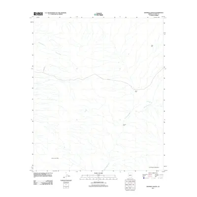
2011 Map of Deepwell Ranch
USGS Topo · Published 2011About this map
Deepwell Ranch and Cross X Ranch define the settlement pattern of this desert landscape in Cochise County, where ranching infrastructure persists along the drainage systems of the Tres Alamos Wash. The terrain is characterized by the broad expanse of Allen Flat in the northeast, transitioning into the elevations of the Johnny Lyon Hills to the southwest and the edge of the Little Dragoon Mountains in the southeast. Sparse transportation routes such as 3 Links Rd and Gamez Rd provide the primary access through this arid region. Water management is critical for the local ranching operations, evidenced by the presence of Mesa Tank and Sunnybrook Tank, which capture runoff in an area where seasonal flows like the Palomas Wash shape the geography. This map illustrates the intersection of traditional Arizona cattle country and modern land management at the start of the 2010s.
Find a feature on this map
11 named features on this map. Tap any name to fly to it.
Don’t see what you’re looking for? This feature index may not catch every label — zoom into the map to look around manually.
Map Details
Editions of this 2011 Deepwell Ranch Map
This is the sole edition of this map. No revisions or reprints were ever made.
Other maps of this area

1943 · Dragoon
USGS Topo · 1:62,500

1943 · Winchester Mts.
USGS Topo · 1:62,500

1945 · Redington
USGS Topo · 1:62,500

1945 · Winchester Mts.
USGS Topo · 1:62,500

1945 · Happy Valley
USGS Topo · 1:62,500

1956 · Tucson
USGS Topo · 1:250,000

1957 · Redington
USGS Topo · 1:62,500

1957 · Winchester Mts.
USGS Topo · 1:62,500

1958 · Tucson
USGS Topo · 1:250,000

1958 · Happy Valley
USGS Topo · 1:62,500