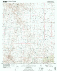
1996 Map of Deepwell Ranch
USGS Topo · Published 2001About this map
Deepwell Ranch sits at the convergence of high desert drainage systems in Cochise County, positioned near the foot of the Little Dragoon Mountains and the Johnny Lyon Hills. The landscape is defined by the broad expanse of Allen Flat to the northeast and the branching paths of Palomas Wash and Tres Alamos Wash. The distribution of essential water resources is mapped through several named infrastructure points, including Sunnybrook Tank, Mesa Tank, and a larger Water Tank near the northern boundary. This 1996 survey, derived from imagery and 1978 topography, details the cattle-ranching geography of the region, showing the relationship between natural terrain and the human-engineered water systems necessary to sustain life and livestock in this arid Arizona corridor.
Find a feature on this map
13 named features on this map. Tap any name to fly to it.
Don’t see what you’re looking for? This feature index may not catch every label — zoom into the map to look around manually.
Map Details
Editions of this 1996 Deepwell Ranch Map
This is the sole edition of this map. No revisions or reprints were ever made.
Other maps of this area

1943 · Dragoon
USGS Topo · 1:62,500

1943 · Winchester Mts.
USGS Topo · 1:62,500

1945 · Redington
USGS Topo · 1:62,500

1945 · Winchester Mts.
USGS Topo · 1:62,500

1945 · Happy Valley
USGS Topo · 1:62,500

1956 · Tucson
USGS Topo · 1:250,000

1957 · Redington
USGS Topo · 1:62,500

1957 · Winchester Mts.
USGS Topo · 1:62,500

1958 · Tucson
USGS Topo · 1:250,000

1958 · Happy Valley
USGS Topo · 1:62,500