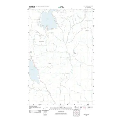
2011 Map of Deer Lake
USGS Topo · Published 2011About this map
Deer Lake and the surrounding peaks of southern Stevens and northern Spokane counties define this 2011 landscape. The map details a transition from the water-oriented residential clusters along the lake's northern and western shores—marked by streets like Hemlock Rd and Tamarack Bay RD—to the more isolated industrial and rural spaces to the east and south. Significant elevation is captured at Deer Lake Mountain and Blue Grouse Mountain, with the latter being the site of the Little King Mines. The drainage system of Dragoon Creek is central to the area's geography, regulated in part by the Kedric Baker Dam. Cultural history is anchored by the Zion Hill Cemetery located near the southern margin, providing a point of interest for genealogists researching the families of this timber and mining region.
Find a feature on this map
51 named features on this map. Tap any name to fly to it.
Don’t see what you’re looking for? This feature index may not catch every label — zoom into the map to look around manually.
Map Details
Editions of this 2011 Deer Lake Map
This is the sole edition of this map. No revisions or reprints were ever made.
Other maps of this area

1901 · Spokane
USGS Topo · 1:125,000

1927 · Chewelah
USGS Topo · 1:125,000

1930 · Chewelah
USGS Topo · 1:125,000

1936 · Newport
USGS Topo · 1:96,000

1942 · Newport
USGS Topo · 1:125,000

1944 · Clayton
USGS Topo · 1:62,500

1949 · Deer Park
USGS Topo · 1:62,500

1950 · Clayton
USGS Topo · 1:62,500

1951 · Deer Park
USGS Topo · 1:62,500

1955 · Spokane
USGS Topo · 1:250,000