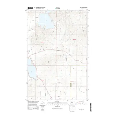
2014 Map of Deer Lake
USGS Topo · Published 2014About this map
Deer Lake and the northern reaches of Clayton define this portion of the border between Stevens and Spokane counties. The landscape is characterized by prominent peaks, including Blue Grouse Mtn and Deer Lake Mtn, which frame the deep basin of the lake. Toward the south, the settlement of Clayton lies near the headwaters of Beaver Cr, while the village of Loon Lake occupies the western edge of the quadrangle. For genealogists and local historians, the Zion Hill Cem is a notable landmark situated near W Mason Rd. Transportation throughout the area is facilitated by a network of rural routes such as Gardenspot Rd and Us-395, reflecting a transition from the agricultural and timbered uplands to the smaller residential clusters surrounding the various water bodies and creek drainages like Dragoon Cr.
Find a feature on this map
53 named features on this map. Tap any name to fly to it.
Don’t see what you’re looking for? This feature index may not catch every label — zoom into the map to look around manually.
Map Details
Editions of this 2014 Deer Lake Map
This is the sole edition of this map. No revisions or reprints were ever made.
Other maps of this area

1901 · Spokane
USGS Topo · 1:125,000

1927 · Chewelah
USGS Topo · 1:125,000

1930 · Chewelah
USGS Topo · 1:125,000

1936 · Newport
USGS Topo · 1:96,000

1942 · Newport
USGS Topo · 1:125,000

1944 · Clayton
USGS Topo · 1:62,500

1949 · Deer Park
USGS Topo · 1:62,500

1950 · Clayton
USGS Topo · 1:62,500

1951 · Deer Park
USGS Topo · 1:62,500

1955 · Spokane
USGS Topo · 1:250,000