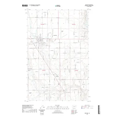
2020 Map of Deer Park
USGS Topo · Published 2020About this map
Deer Park serves as the central hub of this northern Spokane County landscape, where the transition from organized town streets to the rural expanses of Wild Rose Prairie is clearly defined. The area is characterized by a network of drainage systems, most notably Dragoon Cr and its tributaries, which carve through the terrain near landmarks like Turpentine Hollow. Aviation history is well-represented by both the Deer Park Airport and the more specialized Radial Flyer Airport to the south near Denison. Genealogists will find the locations of Kelly Cem and Woodland Cem essential for local family research. The map also captures several smaller water bodies such as Dragoon Lake and Bailey Lake, alongside infrastructure like the Monroe Road Bridge, reflecting the established community patterns of the early twenty-first century.
Find a feature on this map
131 named features on this map. Tap any name to fly to it.
Don’t see what you’re looking for? This feature index may not catch every label — zoom into the map to look around manually.
Map Details
Editions of this 2020 Deer Park Map
This is the sole edition of this map. No revisions or reprints were ever made.
Other maps of this area

1901 · Spokane
USGS Topo · 1:125,000

1927 · Chewelah
USGS Topo · 1:125,000

1930 · Chewelah
USGS Topo · 1:125,000

1936 · Newport
USGS Topo · 1:96,000

1942 · Newport
USGS Topo · 1:125,000

1944 · Clayton
USGS Topo · 1:62,500

1949 · Deer Park
USGS Topo · 1:62,500

1950 · Clayton
USGS Topo · 1:62,500

1951 · Deer Park
USGS Topo · 1:62,500

1955 · Spokane
USGS Topo · 1:250,000