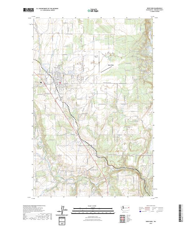
2023 Map of Deer Park
USGS Topo · Published 2023About this map
Deer Park serves as the central hub of this northern Spokane County landscape, characterized by a transition from organized municipal streets to the open reaches of Wild Rose Prairie. The settlement pattern reflects a mix of established residential blocks and surrounding rural developments, with Denison situated to the south along the primary highway corridor. Water is a defining element of the geography, with Dragoon Creek and its many tributaries, including Huston Creek and Wethey Creek, carving through the terrain. To the northwest, Dragoon Lake sits near the edge of town, while the northeastern corner features smaller water bodies like Little Trout Lake and Bailey Lake. Transportation and infrastructure are anchored by the Deer Park Airport, while local heritage is preserved at sites such as Woodland Cem and Holy Redeemer Cem. The map reveals a community deeply integrated with its hydraulic landscape, where numerous small creeks feed into the larger Dragoon system.
Find a feature on this map
67 named features on this map. Tap any name to fly to it.
Don’t see what you’re looking for? This feature index may not catch every label — zoom into the map to look around manually.
Map Details
Editions of this 2023 Deer Park Map
This is the sole edition of this map. No revisions or reprints were ever made.
Other maps of this area

1901 · Spokane
USGS Topo · 1:125,000

1927 · Chewelah
USGS Topo · 1:125,000

1930 · Chewelah
USGS Topo · 1:125,000

1936 · Newport
USGS Topo · 1:96,000

1942 · Newport
USGS Topo · 1:125,000

1944 · Clayton
USGS Topo · 1:62,500

1949 · Deer Park
USGS Topo · 1:62,500

1950 · Clayton
USGS Topo · 1:62,500

1951 · Deer Park
USGS Topo · 1:62,500

1955 · Spokane
USGS Topo · 1:250,000