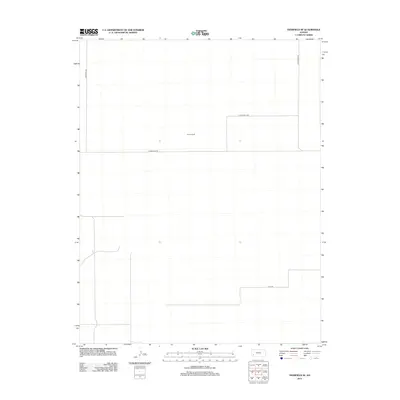
2012 Map of Deerfield SE
USGS Topo · Published 2012About this map
Reeve Ranch sits at the center of this 2012 survey, illustrating the persistence of large-scale agricultural operations in this corner of Finney County. The landscape is defined by a rigorous grid of section lines and gravel paths, where long-established routes like Deerfield Ln and S Holcomb Ln facilitate the movement of local industry. These thoroughfares, including W Parallel Rd and E Pete Smith Rd, represent the essential infrastructure of rural Kansas, connecting isolated homesteads and ranching facilities to the wider region. The sparse distribution of named features highlights the specialized land use typical of the High Plains, where vast stretches of open terrain are managed from central hubs like the Reeve property.
Find a feature on this map
6 named features on this map. Tap any name to fly to it.
Don’t see what you’re looking for? This feature index may not catch every label — zoom into the map to look around manually.
Map Details
Editions of this 2012 Deerfield SE Map
This is the sole edition of this map. No revisions or reprints were ever made.
Other maps of this area

1891 · Larned
USGS Topo · 1:125,000

1896 · Garden
USGS Topo · 1:125,000

1900 · Lakin
USGS Topo · 1:125,000

1955 · Dodge City
USGS Topo · 1:250,000

1958 · Dodge City
USGS Topo · 1:250,000

1959 · Dodge City
USGS Topo · 1:250,000

1959 · Hickok NW
USGS Topo · 1:24,000

1959 · Garden City 3 NW
USGS Topo · 1:24,000

1959 · Hickok NE
USGS Topo · 1:24,000

1960 · Garden City SW
USGS Topo · 1:24,000