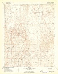
1960 Map of Deerfield SE
USGS Topo · Published 1961About this map
Pleasant Prairie and the surrounding townships in southwestern Kansas are captured here during a period of significant energy development at the turn of the 1960s. The landscape is defined by the transition from cattle ranching to petroleum extraction, evidenced by the central location of the Reeve Ranch surrounded by dozens of active Gas Well and Oil Well sites. These markers underscore the expansion of the Hugoton Gas Area into rural areas like Ivanhoe and Sherlock.
Find a feature on this map
9 named features on this map. Tap any name to fly to it.
Don’t see what you’re looking for? This feature index may not catch every label — zoom into the map to look around manually.
Map Details
Editions of this 1960 Deerfield SE Map
2 editions found
Other maps of this area

1891 · Larned
USGS Topo · 1:125,000

1896 · Garden
USGS Topo · 1:125,000

1900 · Lakin
USGS Topo · 1:125,000

1955 · Dodge City
USGS Topo · 1:250,000

1958 · Dodge City
USGS Topo · 1:250,000

1959 · Dodge City
USGS Topo · 1:250,000

1959 · Hickok NW
USGS Topo · 1:24,000

1959 · Garden City 3 NW
USGS Topo · 1:24,000

1959 · Hickok NE
USGS Topo · 1:24,000

1960 · Garden City SW
USGS Topo · 1:24,000