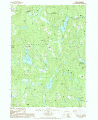
1987 Map of Deering
USGS Topo · Published 1987About this map
The town of Deering and its surrounding hill country are characterized by a network of reservoirs and peaks that define this portion of Hillsborough Co. This late-1980s landscape shows established clusters of settlement at East Deering, Clinton Grove, and the uniquely named Slab City. The terrain is dominated by significant elevations such as Sodom Hill, Gregg Hill, and the ominous Mt Misery, which rise above the interconnected waterways of the Piscataquog River and the Branch Piscataquog River. The prominence of large water bodies like the Deering Reservoir and Pleasant Pond suggests a region defined by managed water resources and seasonal recreation. Conservation areas are well-established, with the large tract of Vincent State Forest in the north and the Perkins Pond State Wildlife Management Area to the east, indicating a landscape where natural preservation and small-town New Hampshire life coexist.
Find a feature on this map
56 named features on this map. Tap any name to fly to it.
Don’t see what you’re looking for? This feature index may not catch every label — zoom into the map to look around manually.
Map Details
Editions of this 1987 Deering Map
This is the sole edition of this map. No revisions or reprints were ever made.
Other maps of this area

1900 · Peterboro
USGS Topo · 1:62,500

1906 · Milford
USGS Topo · 1:62,500

1926 · Hillsboro
USGS Topo · 1:62,500

1927 · Concord
USGS Topo · 1:62,500

1929 · Hillsboro
USGS Topo · 1:62,500

1943 · Fitchburg
USGS Topo · 1:125,000

1948 · Boston
USGS Topo · 1:250,000

1949 · Portland
USGS Topo · 1:250,000

1949 · Concord
USGS Topo · 1:62,500
1953 · Peterborough
USGS Topo · 1:62,500