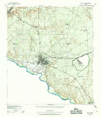
1943 Map of Del Rio
USGS Topo · Published 1969About this map
The border city of Del Rio serves as the focal point of this 1943 War Department survey, showing the community just as Laughlin Field was establishing its military footprint during the war years. The landscape is defined by the confluence of the Rio Grande and the Devils River, with the International Bridge providing a vital link to Coahuila, Mexico. The city's growth is anchored by San Felipe Springs and the historic San Felipe district, while the Sou Pac railroad and the Jefferson Davis Memorial Highway establish the primary east-west transportation corridors.
Find a feature on this map
42 named features on this map. Tap any name to fly to it.
Don’t see what you’re looking for? This feature index may not catch every label — zoom into the map to look around manually.
Map Details
Editions of this 1943 Del Rio Map
This is the sole edition of this map. No revisions or reprints were ever made.
Historical Maps of Del Rio Through Time
4 maps found