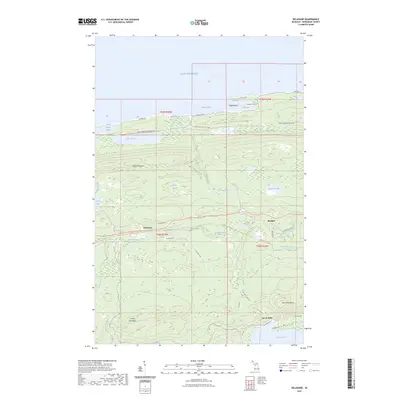
2023 Map of Delaware
USGS Topo · Published 2023About this map
The northern tip of the Keweenaw Peninsula is defined by high ridges and the cold waters of Lake Superior. Steep elevation changes characterize the area around Mount Lookout and Mount Bohemia, providing a dramatic backdrop for the small settlements of Delaware and Mandan. The landscape is etched with complex waterways, including the Montreal River and Silver River, which cascades at Silver River Falls. Along the coastline, Agate Harbor and Grand Marais Harbor offer natural shelter, while the winding Brockway Mountain Dr follows the crest of the interior ridges.
Find a feature on this map
53 named features on this map. Tap any name to fly to it.
Don’t see what you’re looking for? This feature index may not catch every label — zoom into the map to look around manually.
Map Details
Editions of this 2023 Delaware Map
This is the sole edition of this map. No revisions or reprints were ever made.
Other maps of this area

1927 · Point Isabelle
USGS Topo · 1:31,680

1938 · Bruneau Creek
USGS Topo · 1:31,680

1938 · Delaware
USGS Topo · 1:31,680

1939 · Deer Lake
USGS Topo · 1:31,680

1939 · Delaware
USGS Topo · 1:31,680

1940 · Deer Lake
USGS Topo · 1:31,680

1940 · Central
USGS Topo · 1:31,680

1940 · Lake Medora
USGS Topo · 1:31,680

1946 · Bruneau Creek
USGS Topo · 1:24,000

1946 · Eagle Harbor
USGS Topo · 1:24,000